Late season trip to Snowbird Mine
It’s kind of risky to go to a place called Snowbird Mine in western Montana so late in the year.
But I was itching to get out of town for a weekend and my roommate, Jessi, is a rock connoisseur. She had tried to reach the mine for her birthday in late May and her boyfriend made her turn around as they tried to climb the rocky, steep – and probably at that point, still snowy – dirt road to the trailhead, 6,640’ elevation to the top. If I hadn’t already driven four hours to the Idaho border, I honestly might have done the same.
Snowbird Mine, in the Bitterroots, was started as a fluorite mine in 1956 and only used through 1957. Fluorite has historically been used for iron smelting and ornamentally for jewelry. It can also be converted into fluoride for toothpaste.
Jessi, our friend Kate, my dog Margot and I packed up and left Columbia Falls on a Saturday. As we got coffee on our way out of town, the barista asked what we were up to. I told her we were headed to a little mine outside of Missoula and she may be the last person that saw us. She laughed uncomfortably.
We passed through the little town of Alberton west of Missoula and got gas, then marched my poor Rav 4 up Fish Creek Road in Lolo National Forest. We passed several fishermen combing the wide, dark waters. Allegedly there’s trout in fish creek.
The road wasn’t washed out, just rocky and steep. All signs of life disappeared as we passed the campgrounds and fishing sites. I’m sure there were great views, except for the clouds we were gradually climbing towards covering all of that up. We did get a good glimpse of a rainbow, and Jessi remarked, “We’re headed for the gold at the end.”
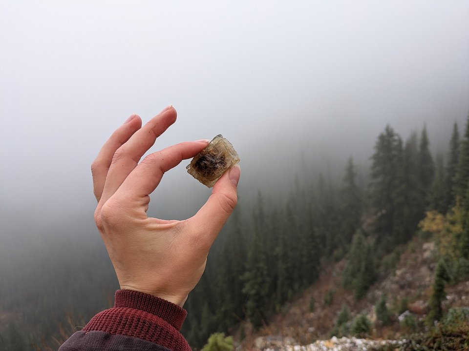
Fluorite is not remotely like gold, though it is sort of pretty. It forms purple, yellow and green crystals based on the impurities in the rock. Pure fluorite will present as a near-clear crystal, they even have that sort of hexagonal crystal shape when you can find a good sample.
Calcite, quartz and parisite are also present at the mine.
I did none of this research before we left. The research Jessi did led us to believe there would be one seasonal gate, one mile from the mine. As it turns out, the Forest Service is capable of more than one seasonal closure.
After we walked a mile past the gate where we parked, we started to question our sanity. None of us had planned for more of a walk than that, and not one of us had a raincoat for the clouds, which at this point were still threatening with little to no follow through. Kate pulled out her phone for the GPS coordinates. Turns out, there is an older gate closer to the mine. But from where we were parked, it was actually four miles one way.
It didn’t look so far on that little screen. We also had something to prove, we couldn’t go home and tell Jessi’s boyfriend we didn’t make it... again.
The hike realistically was not that bad. It’s not terribly scenic, especially when you’re walking through a cloud. Mostly it winds up a Forest Service road back to the older one-mile-from-the-mine gate, then to Stateline Trail No. 738. Although at this point we were technically still in Montana, we will be saying we hiked from Montana to Idaho for the sake of ego. It is right on the border.
Little trees had grown up in the tire tracks of the old road, covered in dew from a dreary day. We got absolutely soaked walking through them. The dog smelled like we hit her with the hose. We didn’t see any signs, but I would say bear spray is a necessity to do that trail, it would be too easy to sneak up on someone. Through the taller trees, suddenly a rocky outcropping was visible high above us, a bald spot on the mountain. It was still further than a mile away.
“That can’t be it,” Kate said.
It was.
We did make it. I’m going to attribute that mostly to a combination of luck and stubbornness. Kate, a new mom, had some snacks on her which we enjoyed while Jessi pored over the rocks.
The mine isn’t what I was thinking, which was tunnels through the mountainside with a sort of Carlsbad Cavern feel. I even brought a head lamp. Rather, the main “hole” barely fit one person in it, a tiny cave framed with wood likely used to store tools at some point in its history. The mine was otherwise open air.
There were definitely signs other rockhounds had made their way up there – beer cans, an abandoned flannel (Jessi said they probably took it from their pack to make more room for rocks) and the rusted end of a hammer. Other miners have already bored man-sized holes in the rockface, and their leftovers are strewn about for the novices (me). Jessi was extremely happy with her belated birthday present from the forest.
It was pretty. I think it’s probably prettier around August.
Our updated directions are: Heading west on US 12, turn right onto Fish Creek Road (FR 343). After about 13 miles, turn left towards Schley Mountain trailhead. Stay to the left of the fork. When you reach the first seasonal gate, walk the remainder of the road past the second gate to Stateline Trail No. 738 up to the mine, about four miles from the parking lot. The GPS coordinates are N46° 46.59780’ / W114° 47.63340’.
When you need to unwind after all of that, Lolo Hot Springs and Jerry Johnson Hot Springs, which we went to, are nearby.


